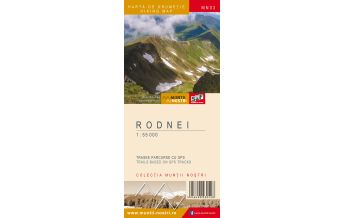
Wanderkarte MN-16, Giumalău, Rarău, Tarnița 1:60.000
Ostkarpaten

Tags
The Giumalau-Rarau-Tarnita Mountains represent a tourist area of great importance in the Eastern Carpathians, consisting of three closely connected massifs, whose importance for tourism derives from the following aspects: the variety of natural landscapes resulted from the diverse landforms and the vegetation; the accessibility due to the presence of the valley corridors surrounding the two massifs. There are two major tourist centers located on the outskirts (Campulung Moldovenesc and Vatra Dornei), which are the main starting points for tourists.
The Giumalau Massif, which represents the western part of the mountain group, is bordered by Moldova Valley in the north, Giumalau and Colbu valleys in the east, Bistrita Valley and Dorna Depression in the south, Bistrita Valley and Mestecanis Pass in the west. The highest point is Giumalau Peak (1857 m) and the massif mainly consists of crystalline schist.
The Rarau Massif, which covers the central part of the mountain group, is bordered by Moldova Valley in the north, Chiril and Gemenea valleys in the southeast that spring from below Prislop Saddle, Bistrita Valley in the south, Giumalau and Colbu valleys in the west. The highest point is Rarau Peak (1651 m). The massif consists of limestone and it is where the famous Pietrele Doamnei (The Lady's Stones) rock formation was created.
The Tarnita Massif, which represents the eastern/south-eastern part of the mountain group, less known by tourists, is bordered by Chiril and Gemenea valleys in the northwest, Suha and Cotargasi (the border with Stanisoara Mountains) valleys in the east, Bistrita Valley in the south and west. The highest point is Batca Oblancului (1474 m). The massif consists of limestone that hosts
The map of Giumalau-Rarau-Tarnita Mountains (MN16) is the 16th map of the new Muntii Nostri collection.
The map was edited using the latest mapping techniques and it was printed on moisture resistant paper. It is easy to read and simple to use due to the mapping styles, specific to Schubert & Franzke company, and as a result of practical information structuring. It is handy and everything is exactly where it should be. The map is useful for both hiking enthusiasts and professionals.
The Rarau area was digitized at a more detailed scale: 1 : 20 000.
All the trails have been recorded in the field using a GPS. They are described in detail in both Romanian and English, some trails having representative images attached to them. Each trail has a technical box containing: trail marking checked in the field, trail route, profile with major landmarks, data on difficulty, length, total ascent, total descent, round-trip time, practicability depending on the season and so on. The map also contains the UTM grid, a projected coordinate metric system useful in the quick measurement of distances on the map. Shading and contour lines highlight the landscape and facilitate orientation.
Weight:
60 g
Publisher:
Series:
Scale:
1:60.000
Product Type:
Maps
Language:
English, Romanian
EAN:
5948490930320
Year of publication:
2018
Continent: Europe
Country: Romania
Region: Ostkarpaten, Bukowina
Places / Mountains / Lakes: Vatra Dornei, Stulpicani, Ostra, Frasin, Vama, Bro?teni, Mun?ii Rarau, Pojorâta, Giumalau, Campulung Moldovenesc
Write Your Own Review
No manufacturer information and safety instructions available yet.