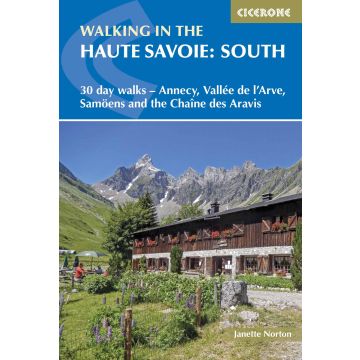
Walking in the Haute Savoie: South (Südliches Ober-Savoyen)
30 day walks - Annecy, Vallée de l'Arve, Samoëns and the Chaîne des Aravis

Tags
A guidebook of walks in the lovely Haute Savoie mountains of France. This guide describes 30 circular routes of between 7 and 20km, based around Annecy, La Clusaz, Grand Bornand, Plateau d'Assy, Samoëns, Sixt, Sallanches, Thônes, la Roche-sur-Foron. Graded from easy to difficult, there are walks to suit most abilities, but a few have some exposed sections and need a head for heights.
The guidebook is divided into 6 areas covering the Arve Valley, the Haut Giffre valley, the Chaîne des Aravis (north and south), Plateau de la Borne and Lake Annecy. Alongside a detailed route description and map, each walk has a summary of all you need to know before you set out (distance, time to walk, ascent, maximum altitude, grade and instructions for accessing the start). There is advice on travel, accommodation and equipment, as well as information about local wildlife and Savoyard food and drink, and a glossary of useful French words.
Visitors flock to the Chamonix area and the Mont Blanc range, but that is only part of what the Haute Savoie has to offer. With stunning views of high mountains as well as lower peaks to enjoy, the walks in this guide will show you a quieter, less busy side to this outstandingly beautiful area.
A guidebook to 30 walks in southern Haute Savoie. Exploring the dramatic scenery of the French Alps between Chamonix and Annecy, the walks are suitable for beginner and experienced walkers alike.
Routes range from 7 to 20km (4–12 miles) and can be enjoyed in 3–8 hours. Walks have been graded from easy to difficult allowing you to choose routes suitable for your ability.
- 1:50,000 maps are included for each route
- GPX files available to download
- Detailed information on planning, accommodation and transport
- Part of a 2-volume set, an accompanying Cicerone guidebook Walking in the Haute Savoie: North is also available
Weight:
300 g
Author:
Publisher:
Series:
Product Type:
Books
Language:
English
EAN:
9781852848118
hoehe_mm:
172
breite_mm:
116
Year of publication:
2020
Categories: Hiking Guides
Write Your Own Review
Manufacturer
- Name: Cicerone Press Ltd.
- Address: Juniper House, Murley Moss Business Village, Oxenholme Road, LA9 7RL Kendal, Cumbria, Vereinigtes Königreich
- Email: info@cicerone.co.uk
Responsible for the EU
- Name: Easy Access Systems Europe
- Address: Mustamäe tee 50, 10621 Tallinn, Estland
- Email: gpsr.requests@easproject.com