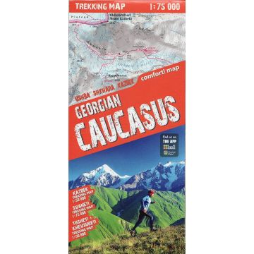
Terraquest Trekking Map Georgian Caucasus/Georgischer Kaukasus 1:75.000
Ushba/Ušba/Uschba, Shkhara/Šchara/Schchara, Kazbek/Kasbek

Tags
An excellent, perfectly comfortable to use trekking map of the Georgian part of the Caucasus Mountains main range. It stands out for its precise topographic and touristic content. It has been created especially for active people setting off for trekking in the area of Svaneti (a map in 1:75,000 scale), Tusheti and Khevsureti (a map in 1:110,000 scale) and the peak of Kazbek (a map in 1:50,000 scale).
The map is characterized by:
– a wide range, including the most interesting regions of the Georgian Caucasus – the environs of Ushba and Shkhara peaks in Svaneti, the trekking route from Omalo to Shatili in the area of Tusheti and Khevsureti, as well as the most popular peak Kazbek,
– rich touristic content, including trekking routes, touristic infrastructure, natural attractions and other objects of interest,
– shading relief showing the lie of the land,
– compatibility to the GPS – geographical coordinates in WGS-84 system.
Weight:
128 g
Publisher:
Series:
Scale:
1:75.000
Language:
English, French, German, Italian, Polish, Spanish
EAN:
9788361155713
Year of publication:
2020
Write Your Own Review
No manufacturer information and safety instructions available yet.


