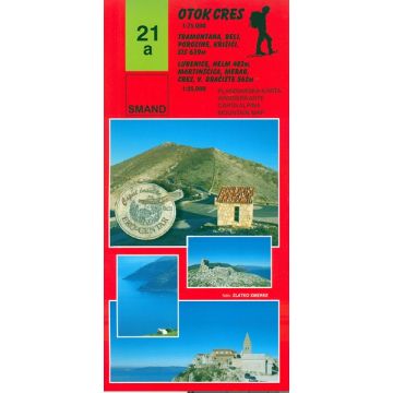
Smand-Wanderkarte 21a, Otok/Insel Cres 1:25.000/1:34.000
Kvarner Bucht

Tags
Planinarska karta - Wanderkarte - Carta alpina - Mountain map
Mjerilo/Maßstab: 1:25.000 i 1:34.000 Dimenzije: 970x680 mm, višebojni zemljovid Područje: Cijeli otok Cres u mjerilu 1:75.000 Detalji u mjerilu 1:25.000/Detailausschnitte im Maßstab 1:250.000: a.) Grad Cres, Merag, Vele Gračišće, Predošćica; b.) Križići, Sis, Beli, Porozina (predjeli Tramuntane; Eko-Centar Beli; "Caput insulae"); c.) Martinščica, Helm, Lubenica; Vrhovi/Gipfel: Vele Gračište 562 m, Sis 639 m, Helm 487 mThe first page of the map shows the area:
1. Cape Jablanac-Porozina-Beli-Križić-Predošćica, an area known as Tramuntana; scale 1:25.000
2. Predošćica-Velo Gradišće- Merag (ferry port)-town Cres, scale 1:25.000
On the back of the map are two areas:
3. City of Cres-Loznati-Orlec-Valun-Pernat-Lubenice-Vransko jezero-Martinšćica-Miholascica; scale 1:34.000
4. Miholašćica-Stivan-Ustrine-Belej-Srem-Plat-Verin-Grad Osor-
Punta Križa; scale 1:34.000
Mjerilo/Maßstab: 1:25.000 i 1:34.000 Dimenzije: 970x680 mm, višebojni zemljovid Područje: Cijeli otok Cres u mjerilu 1:75.000 Detalji u mjerilu 1:25.000/Detailausschnitte im Maßstab 1:250.000: a.) Grad Cres, Merag, Vele Gračišće, Predošćica; b.) Križići, Sis, Beli, Porozina (predjeli Tramuntane; Eko-Centar Beli; "Caput insulae"); c.) Martinščica, Helm, Lubenica; Vrhovi/Gipfel: Vele Gračište 562 m, Sis 639 m, Helm 487 m
Weight:
66 g
Publisher:
Series:
Scale:
1:25.000
Product Type:
Maps
Language:
Bosnian-Croatian-Serbian, English, German, Italian
EAN:
9789537163181
hoehe_mm_offen:
680
Year of publication:
2023
Write Your Own Review
No manufacturer information and safety instructions available yet.


