Tags
Hier geht's zum interaktiven Blattschnitt der Nordeca-Karten.
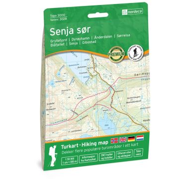
Topo 3000 is a detailed map covering over 3000 km2. Anyone going to Northern Senja should visit the popular top Segla 693 meters above sea level. From the top you can see 600 meters down in the Mefjord, nothing for the one with the horror. The path to the top is well marked. The trip to Husfjellet offers most of the mountain peaks the area has to offer. From here you can see the Berg Islands and the mountains in northern Torsken, Okshornan, Ersfjorden and Steinfjorden. Together with the map Senja south, the whole area for the trip "Senja along" is covered. Here you will find tours such as: Top trip to Barden with a tour on the edge of Heia at Segla 7.7 km, Husfjellet 632 masl, 4 km, Breidind 1001 masl. 3.7 km. Example of cabins: Heggedalshytta (unattended). Destinations: Gryllefjord, Blåfjellet, Dyrøyhamn, Ånderdalen, Finnfjordbotn, Sørreisa, Finnsnes, Senja, Gibostad, Solbergfjorden, Leiknes, Kistefjellet, Stonglandseidet
Topo 3000 is a detailed map covering over 3000 km2. Anyone going to Northern Senja should visit the popular top Segla 693 meters above sea level. From the top you can see 600 meters down in the Mefjord, nothing for the one with the horror. The path to the top is well marked. The trip to Husfjellet offers most of the mountain peaks the area has to offer. From here you can see the Berg Islands and the mountains in northern Torsken, Okshornan, Ersfjorden and Steinfjorden. Together with the map Senja south, the whole area for the trip "Senja along" is covered. Here you will find tours such as: Top trip to Barden with a tour on the edge of Heia at Segla 7.7 km, Husfjellet 632 masl, 4 km, Breidind 1001 masl. 3.7 km. Example of cabins: Heggedalshytta (unattended). Destinations: Gryllefjord, Blåfjellet, Dyrøyhamn, Ånderdalen, Finnfjordbotn, Sørreisa, Finnsnes, Senja, Gibostad, Solbergfjorden, Leiknes, Kistefjellet, Stonglandseidet
Write Your Own Review
No manufacturer information and safety instructions available yet.


