Maps International Planokarte - Nordamerika North America 1:7.000.000
100 x 120 cm
Tags
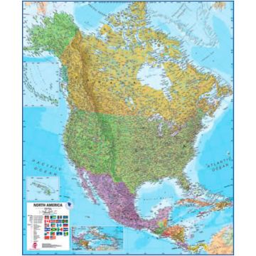
[:de]Maps International's North America political wall map covers a huge expanse of land from Alaska and Canada through the United States down to Mexico, Central America and the Caribbean.
North American political map detail: This political wall map of North America features countries shown in different colours, international boundaries and major transport networks. The wall map also contains a panel of flags relating to the countries shown in this North American continent map. Also shown is city population detail, capital cities and all the major towns and cities in this continent of North America.
Map uses: As with most of our maps, the North American political wall map, is available in a range of finishes making it suitable for a variety of locations. Ideal for an office, classroom or when planning a trip to this American continent.[:]
Verlag: Maps International Produktdetails: EAN: 9781904892007
Verlag: Maps International Produktdetails: EAN: 9781904892007
Publisher:
Scale:
1:7.000.000
Product Type:
Maps
EAN:
9781904892007
Year of publication:
2019
Categories: America
Write Your Own Review
No manufacturer information and safety instructions available yet.