Tags
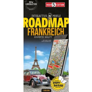
The first water-resistant roadmap with direct access to useful additional information from the InternetFrance, including Corsica, in a scale of 1:800,000 shown on a practical map; inclusive of the High 5 Edition app technology for calling up additional travel information and many other benefits:practical format (11.4 x 23.5 cm)it is water-resistant (laminated/cellophane coating)the UNESCO World Heritage Sites are listed on the mapcontains a selection of the local index including postal codes; the entire index can be viewed using the QR-codeIt doesn’t matter what weather it is used in or how often it is folded, the condition of the “ROADMAP France” will not deteriorate. Roads, ascents, woodland and mountain areas are easily recognisable thanks to the clear layout of the map. There is also a brief informative section about France (speed limits, area codes, emergency numbers, etc.)The “Interactive Mobile ROADMAP France” – a “paper backup” just in case...
... and when used in conjunction with a smartphone, it is a great tool for planning trips.What’s not on the map is in the app
By scanning the section of the map you want with the High 5 Edition app, you can get a lot of useful additional information about major attractions and cities in France. The app is based on Augmented Reality technology and is available free of charge from the Apple App store and Google Play store. More information on www.high5edition.com
Weight:
128 g
Publisher:
Scale:
1:800.000
Product Type:
Maps
Language:
English, French, German, Italian
EAN:
9783906908090
hoehe_mm:
235
breite_mm:
114
Year of publication:
2017
Categories: Road Maps
Write Your Own Review
No manufacturer information and safety instructions available yet.