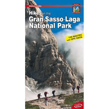
Hikes in the Gran Sasso-Laga National Park
Abruzzen

Tags
The National Park that embraces Gran Sasso, the Montagne Gemelle and Monti della Laga is one of the largest and most spectacular in Italy. Within its boundaries are the rocky peaks of the two Corni, the solemn upland plain of Campo Imperatore, the forests and the surprising cascades of the Laga chain. In the Park you can see chamois, wolves, deer and golden eagles, admire the bright blossoms of springtime, and discover the Calderone, Europe’s southernmost glacier. Among the traces left by man over thousands of years are Italic necropolises, medieval fortresses, sheep-tracks and villages where time stands still. Hiking through the Park also means discovering local traditions and cuisine.
In a practical format, enriched by 300 of the author’s photographs, this guide describes 120 itineraries for exploring the many aspects of the Park, including easy walks suitable for all, more demanding treks, and hiking/mountaineering itineraries. Detailed descriptions of the itineraries are supplemented by technical information (elevation gain, time required, difficulty, trail markings, GPS data) fundamental for planning a hike.
The guide is enriched by 7 maps in the scale of 1:100,000 and a detailed map of the central area of Gran Sasso in the scale of 1:25,000.
Weight:
100 g
Author:
Publisher:
Product Type:
Books
Language:
English
EAN:
9788881772063
Year of publication:
2013
Continent: Europe
Country: Italy
Region: Monti della Laga, Abruzzen
Places / Mountains / Lakes: Gran Sasso, Monte Gorzano, Amatrice, Prati di Tivo, Campo Imperatore, Lago di Campotosto, Monte Corvo, Fonte Vetica, Umito, Capricchia
Categories: Hiking Guides
Write Your Own Review
No manufacturer information and safety instructions available yet.

