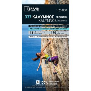
Terrain Map 337, Kálymnos 1:25.000
Dodekanes

Tags
All climbing crags
Fabulous cliffs and impeccable organization have made Kalymnos one of the top rock climbing destinations worldwide. This is the first map of Kalymnos to accurately feature all climbing crags on the island.
It is the first time the island’s entire coastline is mapped. Survey was done with TERRAIN’s specially equipped and staffed cartographic vessel. This means that you can locate all beaches of the island, down to the tiniest cove!
It features the most complete road network and the trails of Kalymnos with accuracy and precision, since the cartographers of TERRAIN walked them one-by-one. The length of all trails is measured in kilometers so you can estimate the duration of your hike, plus the descriptions of the 13 most important trails are featured on the back. Certain trails appearing on other maps but not on our own are either the trails which run through open terrain, or the extremely rough trails, which would put the average hiker at risk –hence, we opted not to include them in our map of Kalymnos. In contrast, our map exclusively features the most useful trails, which are those leading to the island’s climbing crags.
Scale/Maßstab: 1:25.000
Edition/Auflage: 3rd edition 2019
Printed on PolyArt
Gewicht:
77 g
Verlag:
Reihe:
Maßstab:
1:25.000
Medienart:
Karten
Sprache:
Englisch, Neugriechisch
EAN:
9789606845901
Erscheinungsjahr:
2019
Schreibe deine eigene Bewertung
Noch keine Herstellerangaben und Sicherheitshinweise verfügbar.