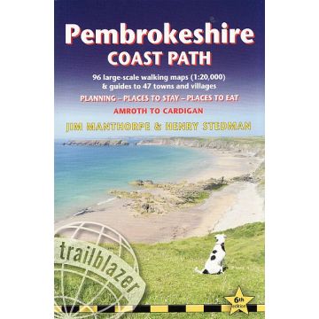
Pembrokeshire Coast Path
Wales

Tags
236 pages, 96 maps, 10 stage maps, 1 overview map
29 colour pages + 3pp colour flower guide
The Pembrokeshire Coast Path follows a National Trail for 186 miles (299km) around the magnificent coastline of the Pembrokeshire Coast National Park in south-west Wales. Renowned for its unspoilt sandy beaches, secluded coves, tiny fishing villages and off-shore islands rich in bird and marine life, this National Trail provides some of the best coastal walking in Britain. With accommodation, pubs and restaurants in detailed guides to 47 towns and villages including Tenby, Pembroke, St David's, Fishguard and Cardigan. Completely rewalked and all information rechecked Features The largest scale walking maps available – at just under 1:20,000 – our maps are bigger than even the most detailed walking maps currently available elsewhere Unique mapping features - in many walking guides the reader has to read a route description then try to relate it to the map. Our guides are easier to use because walking directions, tricky junctions, places to stay and eat, points of interest and walking times are all written onto the maps themselves in the places to which they apply. Downloadable GPS waypoints also included. Itineraries for all walkers – whether walking the route in its entirety over two weeks or sampling the highlights on daywalks and short breaks All-in-one-guide – reviews of places to stay (campsites, hostels, B&Bs, pubs and hotels), places to eat, attractions along the way Comprehensive public transport information for weekend and day walks– all access points on the path
The Pembrokeshire Coast Path follows a National Trail for 186 miles (299km) around the magnificent coastline of the Pembrokeshire Coast National Park in south-west Wales. Renowned for its unspoilt sandy beaches, secluded coves, tiny fishing villages and off-shore islands rich in bird and marine life, this National Trail provides some of the best coastal walking in Britain. With accommodation, pubs and restaurants in detailed guides to 47 towns and villages including Tenby, Pembroke, St David's, Fishguard and Cardigan. Completely rewalked and all information rechecked Features The largest scale walking maps available – at just under 1:20,000 – our maps are bigger than even the most detailed walking maps currently available elsewhere Unique mapping features - in many walking guides the reader has to read a route description then try to relate it to the map. Our guides are easier to use because walking directions, tricky junctions, places to stay and eat, points of interest and walking times are all written onto the maps themselves in the places to which they apply. Downloadable GPS waypoints also included. Itineraries for all walkers – whether walking the route in its entirety over two weeks or sampling the highlights on daywalks and short breaks All-in-one-guide – reviews of places to stay (campsites, hostels, B&Bs, pubs and hotels), places to eat, attractions along the way Comprehensive public transport information for weekend and day walks– all access points on the path
Autor:
Henry Stedman, Jim Manthorpe
Verlag:
Medienart:
Bücher
Sprache:
Englisch
EAN:
9781912716135
Seiten:
236
Höhe in mm:
180
Breite in mm:
120
Erscheinungsjahr:
2021
Kategorien: Wanderführer, Weitwandern
Schreibe deine eigene Bewertung
Noch keine Herstellerangaben und Sicherheitshinweise verfügbar.