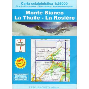
Escursionista-Skiwanderkarte Monte Bianco/Mont Blanc, La Thuile, La Rosière 1:25.000
Mont Blanc-Massiv

Tags
• Edition: First
• Year: 2016
• Size: 12x17 (guide-book) - 70x100 printed on both sides (map)
• Pages: 48 (guide-book) + 1:25.000 (map)
• Photo: Color
• Binding: Stapled
• ISBN: 9788898520404
• Code: ESC01S
Ski-mountaineering map of the Monte Bianco range, La Thuile and La Rosière at 1:25.000 scale with a WGS84 grid (1km), printed on support extra strong and waterproof. The product comes in a plastic cover with a photographic booklet included.
Produktdetails: EAN: 9788898520404 Auflage: 2016
Produktdetails: EAN: 9788898520404 Auflage: 2016
Verlag:
Maßstab:
1:25.000
Medienart:
Karten
Sprache:
Deutsch, Englisch, Französisch, Italienisch
EAN:
9788898520404
Kontinent: Europa
Land: Italien, Frankreich
Bundesland / Provinz: Aostatal, Auvergne-Rhône-Alpes
Orte / Berge / Seen: Mont Blanc, Courmayeur, La Thuile, Mont Dolent, Val Ferret, Val Veny, Entrèves, Grande Rochère, Mont Berio Blanc, Morgex, Valgrisenche, Kleiner St. Bernhard, La Salle, Mont Paramont
Kategorien: Skitourenkarten