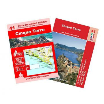
Escursionista-Karte 41, Cinque Terre 1:25.000
Ligurien

Tags
With the series "the best walks" a new series of practical and handy booklets is inaugurated which will accompany the 1:25,000 scale maps of the Piedmont and Ligurian territory. The map is printed front and back on a recyclable, waterproof and tear-proof support and all the paths reported (signposted and without signs) have been recorded with GPS satellite equipment. The cartographic drawing, with rocks, gravels and glaciers, was created on recent aerial photographs. In a handy 2-pocket case, for the same purchase price as the card alone, you will also find the color guide with the description of 9 excursions selected among the most beautiful in the area, with historical-cultural insights and color illustrations, in Italian, French and English.
- L'Isola di Palmaria e Muzzerone
- 2 L'anello di Tramonti
- 3 Un anello da Riomaggiore
- 4 Da Corniglia a Riomaggiore
- 5 Da Corniglia a Vernazza
- 6 Da Monterosso a Vernazza
- 7 Da Monterosso a Levanto
- 8 Le borgate di Levanto
- 9 La Rossola
- Edizione/Auflage: Prima
- Anno/Erscheinungsjahr: 2023
- Formato/Format: 12x16.5 (guida) - 70x100 (carta)
- Pagine/Seitenzahl: 80 (guida) + 1:25.000 (carta)
- Foto: col
- Rilegatura/Bindung: Pinzato
- ISBN: 9791280163097
- Codice: ESC41
Gewicht:
220 g
Verlag:
Maßstab:
1:25.000
Medienart:
Karten
Sprache:
Deutsch, Englisch, Französisch, Italienisch
EAN:
9791280163097
Höhe in mm:
165
Breite in mm:
120
Höhe in mm offen:
700
Breite in mm offen:
120
Erscheinungsjahr:
2023
Kontinent: Europa
Land: Italien
Bundesland / Provinz: Ligurien
Region: Riviera di Levante, Ligurisches Meer, Cinque Terre, Italienische Riviera, Nördlicher Apennin
Orte / Berge / Seen: La Spezia, Portovenere, Levanto, Bonassola, Vernazza, Riomaggiore, Corniglia, Campiglia, Pignone
Schreibe deine eigene Bewertung
Noch keine Herstellerangaben und Sicherheitshinweise verfügbar.

