Tags
Carte de randonnées - hiking map - mapa excursionista - Wanderkarte
waterproof
Auflage: 2018
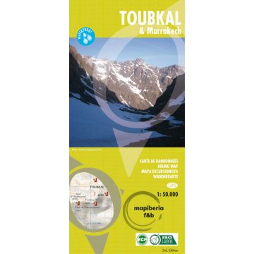
A detailed, accurate and up-to-date trekking map of Jebel Toubkal in the High Atlas mountains of Morocco, the highest peak in North Africa and a popular trekking destination. The 1:50,000 topographic map detail includes contours at 20m intervals, hill-shading, woodland and scrub areas, springs, creeks, rivers and dry riverbeds.
A detailed, accurate and up-to-date trekking map of Jebel Toubkal in the High Atlas mountains of Morocco, the highest peak in North Africa and a popular trekking destination. The 1:50,000 topographic map detail includes contours at 20m intervals, hill-shading, woodland and scrub areas, springs, creeks, rivers and dry riverbeds.
Road detail includes tracks and footpaths, and funicular railways and ski-lifts are also indicated. Isolated buildings are marked and symbols show ski-stations, refuges and religious buildings.
On the reverse is a clear plan of Marrakech at approximately 1:8,700.
Weight:
106 g
Publisher:
Scale:
1:50.000
Product Type:
Maps
EAN:
9788493560003
Year of publication:
2018
Continent: Africa
Country: Morocco
Region: hoher atlas
Places / Mountains / Lakes: Marrakesch, Imlil, Djebel Ouanoukrim, Oukaimeden, Lac d'Ifni, Tizgui, Amsourzerte, toubkal
Write Your Own Review
No manufacturer information and safety instructions available yet.